
Features Municipalidad en tus manos
It is a new municipal information consultation platform, which arises in response to the need to concentrate in a single place, a wide variety of information that is dispersed throughout cyberspace and whose location sometimes becomes a little complicated.
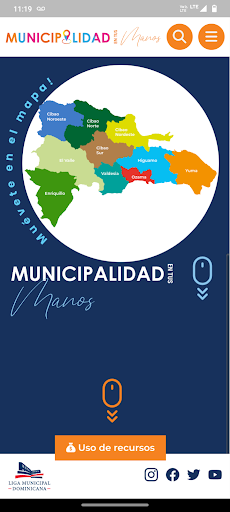
.In addition and as an innovation, specific information is incorporated on the different supports and contributions coming from the Executive Branch and the Dominican Municipal League to the local governments of the country for the improvement of infrastructure and provision of municipal services.FunctioningThe basic interface of this tool presents a map of the Dominican Republic, and summary details of the program with the greatest impact in support of the municipality, which is the Support Program for Local Governments, beginning with the construction of sidewalks and containers from which The status of the transfers and the physical progress of the works are shown.
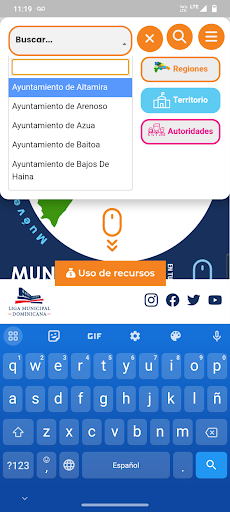
Through this interface, with a click or through the filter by region, by local government or by authority, it is possible to access the 393 geolocated points which correspond to the municipalities (in blue) and the municipal districts (in orange).
that make up the national geography.
The content can be classified according to a wide variety of criteria, making it possible to activate only those points that are relevant to the user at that moment.Types of informationBy activating each of the points that appear on the map, the user will have access to different blocks of information which are strategically distributed to provide a better interpretation of the content of the page.
Food & Dining
Discover recipes and order food from your favorite restaurants.
Offline Mode
Use the app without an internet connection. Your data syncs when you're back online.
Cross-Device Sync
Seamlessly sync your data across all your Android devices.
See the Municipalidad en tus manos in Action
Get the App Today
Available for Android 8.0 and above